The Ada Forest Tramway
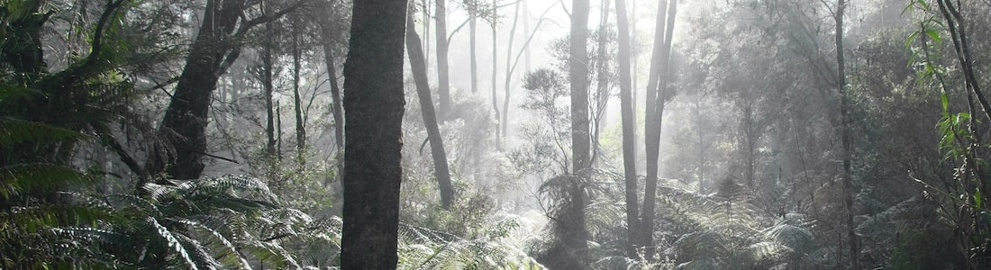
Sunbeams shot between the trees, illuminating the spiderwebs. The fog glowed and swirled in the pale winter sunlight. I felt the chill while I waited for LS to put her boots on, and was anxious to start walking to warm up. Across the road was a brown post carved vertically with “Walk Into History”1, marking the start of our walk along the old timber tramway to the High Lead incline2. Fifty metres to the left was its twin, where the track continued to Powelltown along the La Trobe and Little Yarra Rivers3.
Our track immediately dived into a curved cutting where the tramway had turned into the Big Creek valley. A short section of split-log boardwalk took us to a bridge over the La Trobe River made from a tree trunk with a flattened top and a single handrail.
The river flowed quietly under the bridge. Tannins gave the water the colour of caramel, but it was clear enough to see the sandy bed. Ferns and paperbarks thrived in the swampy conditions. LS walked on ahead while I slowed down to take photos.
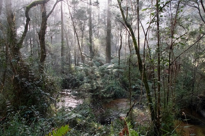 Following the La Trobe River.
The track followed the La Trobe downstream, and I got glimpses of the water through the trees and treeferns. Fog filled the broad valley with a soft light that swallowed the more distant trees. The river wandered off to the east while the track continued on, and shortly after I met Big Creek flowing down to join the La Trobe.
The old tramway formation ran straight along a causeway above the creek. As I got further into the valley it narrowed, and at times treeferns crowded in so thickly as to make a green tunnel. The songs of lyrebirds rang out through the forest, though the singers remained hidden.
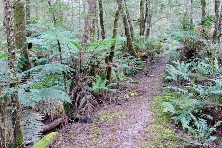 Heading into the Big Creek valley.
The creek shifted from one side of the valley to the other. I crossed it on a twin-log bridge, but it had seen better days with a fallen tree having damaged and blocked half of it. A pretty section followed, passing through beech forest where moss and fungi coated the trees and stones. The fog was melting away and bright sun peeped into the forest, making the shadows all the darker.
A small side creek ran down from the right in a shallow gully. The path wandered along the soft, sandy creek bed on stepping stones, winding between the treeferns. The climb out the other side scaled the embankment from one end of the tramway bridge, though no sign of the structure remained.
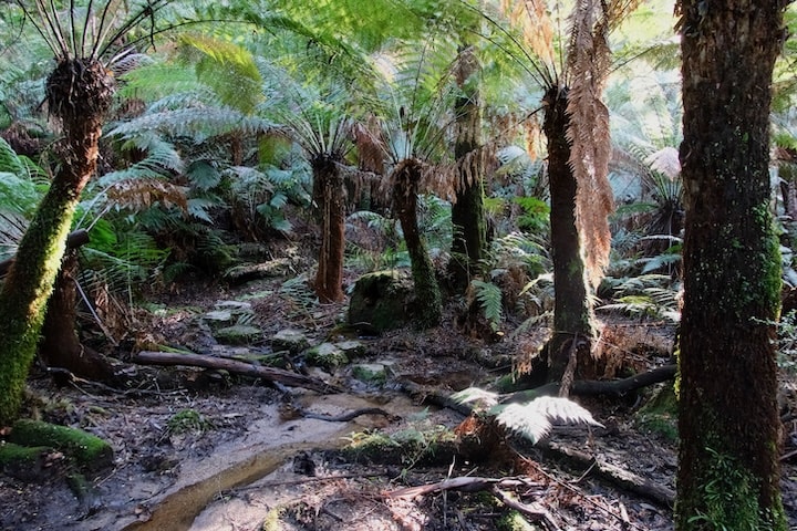 Crossing the creek gully.
As I neared the end of the valley, it became more obvious that this was once a tramway. At times the path was benched into the hillside, or passed through deep, narrow cuttings. A couple of old rails lay half-buried in the leaf litter, and were so weathered that they were hard to spot, given away only by their regular shapes.
After crossing a couple more tributaries, I arrived at what used to be known as Powelltown Bush: a flat space at the foot of the High Lead incline4. The tramway had multiple tracks here to marshal the loaded bogies coming down the incline and empties going back up. Nothing remained to hint that the small track heading straight up the steep hillside was a tramway, but incredibly it was.
As I climbed away from the creek valley the forest quickly changed to be drier and more airy. A short way up a large mountain ash had fallen across the track, but fortunately a gap had been cut out for walkers to pass through — which was just as well, as the trunk stood about shoulder-high.
The climb was steep, but not as bad as I remembered — not yet, anyway. Occasional cuttings on the short flatter sections helped to dispel any doubt that this had been a tramway. An old boiler lay abandoned among the trees, but as this hadn’t been the site of a winch or mill it must have come from elsewhere: possibly from the winch at the top of the incline.
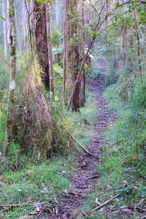 The track steepens after a flatter section.
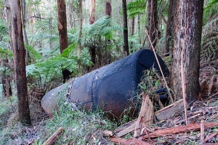 A boiler lies amongst the trees beside the track.
The first stage of the climb ended at a set of steps up to a quiet dirt road, where LS was waiting for me. The low sunlight skimmed the treetops but left us in the blue shade. We decided to take a break, and filled up with bananas and hot tea.
More steps led away from the road to begin the steepest part of the climb, and this time it lived up to my memory. The damp ground was covered with leaves making it difficult to find grip. Treeferns crowded in, draping their huge fronds across the track. We took our time.
The climb was punctuated by short sections where the gradient eased, but never for long, as though the track was impatient to reach the top. At last we made it, having gained over 400 metres in 1·6 kilometres. A broken signpost5 confirmed we were at the site of the winch, but a few mounds of earth in the nondescript forest was all that remained of the steam-powered winch, aerial cable system, and multiple tramway tracks.
The track continued along a gentle descent, and we strolled through the forest enjoying the easy walking. The barking of a dog from close by in the trees surprised us… until it changed into regular birdsong: we’d been fooled by a lyrebird6. We crossed a dirt road marked by another carved brown signpost, and continued down to a small, wet gully. Snaking amongst the ferns were steel cables, discarded remnants of the winch system.
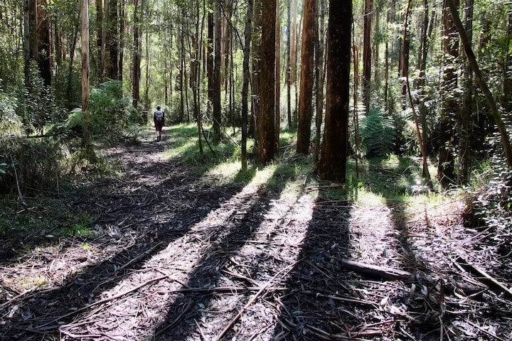 Past the top of the incline was a gentle descent.
Much of the thick undergrowth was mint bush, and its refreshing scent filled the air. Their leaves were pungent and sticky when I crushed them. Wire-grass wound its way through the bushes and ferns, and made its way up the tree trunks.
We dipped into a wide, shallow valley, and the air became distinctly cooler. The vegetation changed abruptly to thickly growing tea tree, sword grass, and coral fern. Off to the right, the sleepy Ada River meandered between the trees. It felt incongruous to find a river up here, seemingly flowing along the ridgetop.
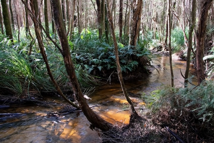 The Ada River.
A boardwalk cut a narrow gap through the trees beside the mossy remains of the tramway bridge. Despite having been abandoned since the 1940s, the huge logs forming the bridge have held their shape and structure. Tangled up with them were scraps of rusty winch cable. The boardwalk took us across a couple hundred metres of swampy ground to the Ada River. The water drifted past slowly in silence.
When we arrived at the site of the Ada No.2 Mill, the first object we found was an old chimney lying on the ground. A couple of clearings contained camping platforms, though they were mossy and damp — everything here was damp. I found the driest spot I could to sit, and took off a boot to put a blister pad on my heel where I could feel a hot spot developing.
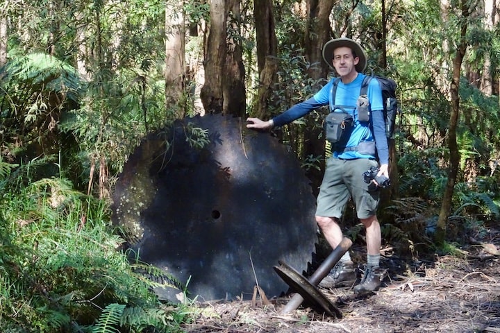 A circular saw blade from the mill, and one of the pulleys used to carry the winch cable.
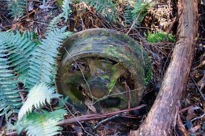 A wheel from a bogie used to transport the logs.
This site rewarded exploration. Near the platforms were a pair of old wheels taken from a bogie, and a huge circular saw blade. An inscrutable steel box was the saddle tank7 from the tiny locomotive “Squirt” that used to work up here (the rest of it was removed long ago).
A small arch of brickwork coated in velvety moss had been the firebox for the mill’s boiler. The boiler itself could hardly be seen from this side, but scrambling up above it gave a much better view. The huge metal cylinder was three-quarters buried in the earth, and looked like a submarine cruising the forest floor.
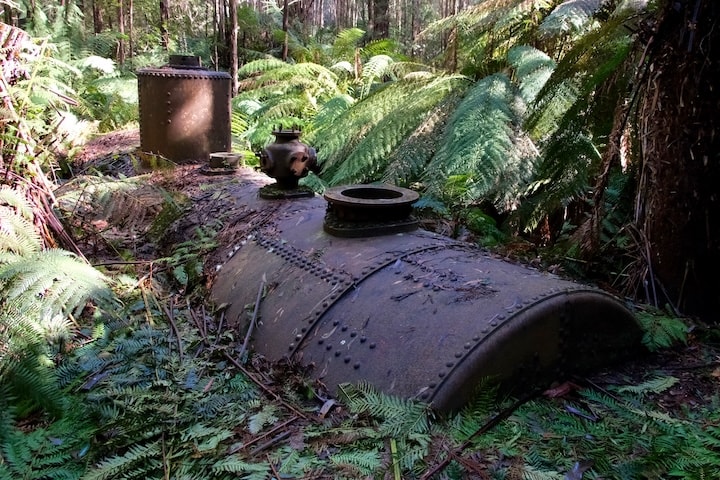 The old boiler is slowly being buried in the earth.
The continuation of the old tramway was bordered by discarded rails. As we left the mill site we found another boiler off in the trees, smaller than the one back at the mill, so I guessed it may have been dumped after being replaced.
We crossed an enchanting little gully on a twisty split-log boardwalk. The whole gully floor tinkled with trickling water. The ferns and moss and shady trees made it a haven of peace, though it must have been starkly different back in the milling days.
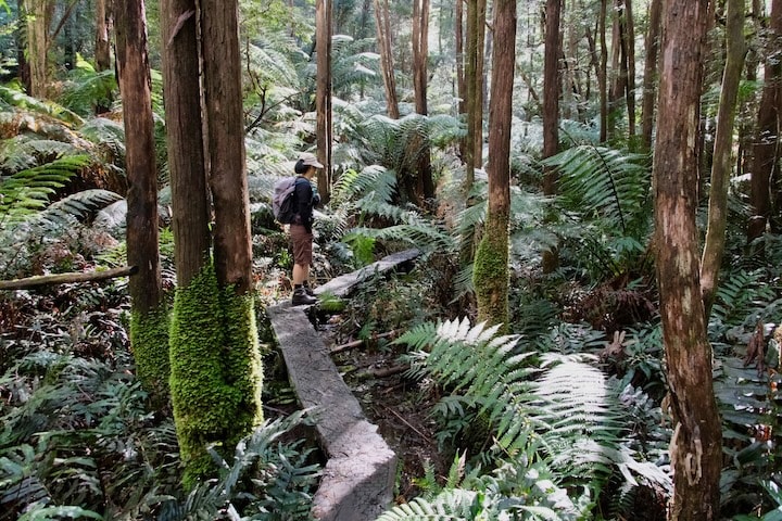 Crossing the gully leaving the mill site.
A short climb brought us to Federal Crossing, where two tramways had met. The Powelltown Tramway we’d been following continued up the hill to the New Ada Mill. Running from left to right was the Federal Tramway, which started in Warburton and ran to the New Federal Mill8, our target for the day. We turned right to follow it.
The Federal Tramway had a completely different character. It maintained modest grades and avoided the need for winching by following the contours of the land. Its winding route was less direct than the straight lines of the Powelltown Tramway, but much easier to operate.
With the track benched into the hillside the walking was easy, apart from the mud — its flatness meant it didn’t drain well. The air was filled with the rich smell of wet earth. A couple of side creeks cut through the track, but no traces remained of the bridges that once spanned them.
Much of the way was so dark and enclosed by treeferns it felt we were burrowing through the forest. The more open sections glowed with light as we approached them, and the wider views of the forest were filled with masses of mountain ash: tall and thin and straight. One sunny glade held some parts from a winch: a spool and the gear that drove it.
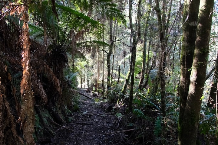 The Federal Tramway.
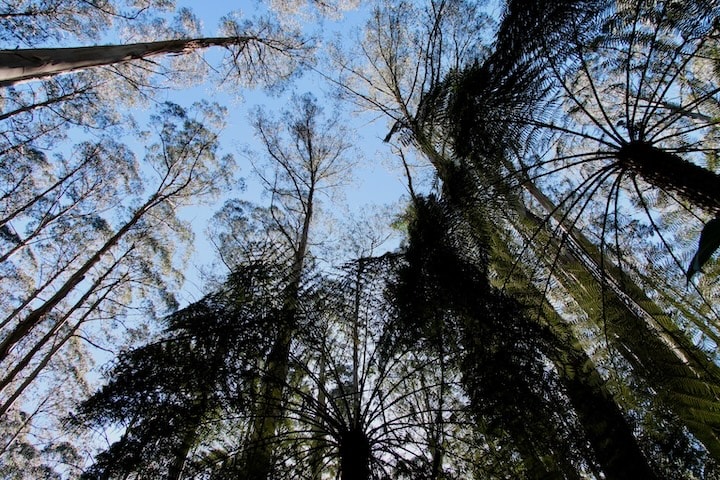 Mountain ash soar above the track.
Our quiet morning ended when a jogger overtook us, then a dozen scouts passed us heading the other way. We reached the Little Ada River a few minutes later to find another couple completing their fording of the river. The track had quickly become busy, but that was everyone we’d meet for the day. The forest was all ours again.
The other rivers we’d crossed had flowed within shallow banks, but unlike them the Little Ada had carved a ravine. The moss-covered remains of a substantial tramway bridge had partially collapsed into the river, making the sign warning us not to use the “dangerous bridge” unnecessary.
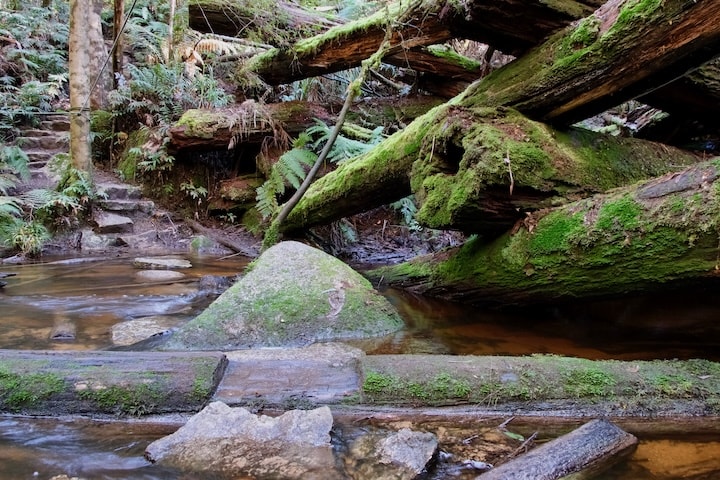 Crossing the Little Ada River next to the collapsed tramway bridge.
Stone steps led down to the river’s edge. Some old climbing rope had been strung between trees to help with fording the river, but it was so slack that it was useful only for moral support. Regardless, we both got across safely by means of fallen trees, and wandered up towards the New Federal Mill, passing a few giant stumps left over from the logging days. Far above us the tops of the tall trees clattered in the wind, though there was no breath of it at ground level.
It was lunchtime when we arrived at the mill site. The only link to the past was a single wheel from a bogie next to an information sign. This was surprising given it was the largest mill in the area, with dozens of buildings and multiple tramways branching off. In their place there was a new picnic shelter and a few camping platforms.
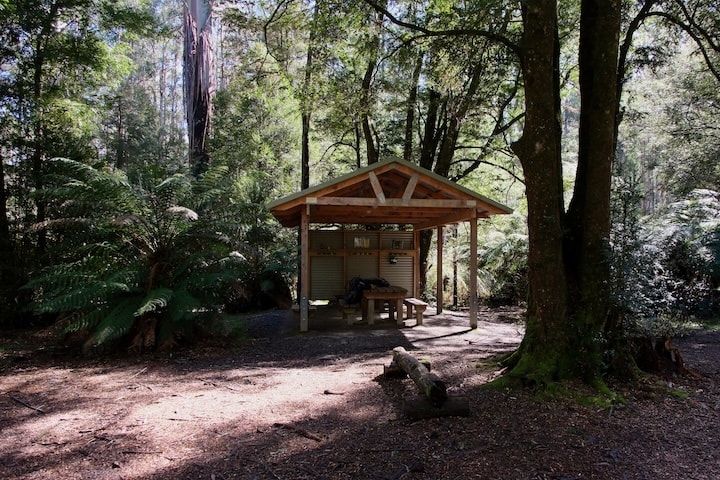 The picnic shelter at the site of the New Federal Mill.
The platforms were much nicer than those at the Ada No.2 Mill, and we chose one for our lunch break. I took my boots off to give my feet a rest in the fresh air. We soaked up the warmth of the sun while we ate our pies and cherry tomatoes, and drank the remainder of the tea. It was peaceful in the bush, silent apart from the treetops swaying in the breeze and the occasional quick flutter of wings.
Reluctantly we got ready to leave, and I put my boots back on. After tying the laces I found a leech attached to my finger. It wasn’t the first for the day, but certainly the boldest.
Back at the Little Ada we tried crossing on the stepping stones right next to the bridge. They were partially submerged even though the river wasn’t particularly high, but one advantage of my big clompy boots is they can handle a few inches of water.
The walk back through the forest was beautiful. The track was lined with treeferns, the sunlight glittering through their fronds. Countless mountain ash towered above, impossibly slender for their height, and crowded together. But they’re all regrowth after the loggers had been through, making them uniformly young by the lifespans of these giants. What would the primeval forest have been like, when massive trees centuries old had reached over a hundred metres into the sky, the rest of the forest contained within their shelter?
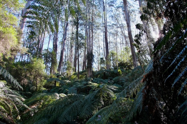 Regrowth forest along the Federal Tramway.
At Federal Crossing we turned left and began descending to the Ada No.2 Mill. Despite it being a gentle slope, I slipped over and LS went over a few moments later. It was an inauspicious start given the extremely steep descent we’d soon face on the High Lead incline, but a timely warning.
We poked around the mill site for a while, then followed the long boardwalk across the swampy section surrounding the Ada River. The moment we left the river valley the air became warmer, and we were greeted by the fresh smell of the mint bushes.
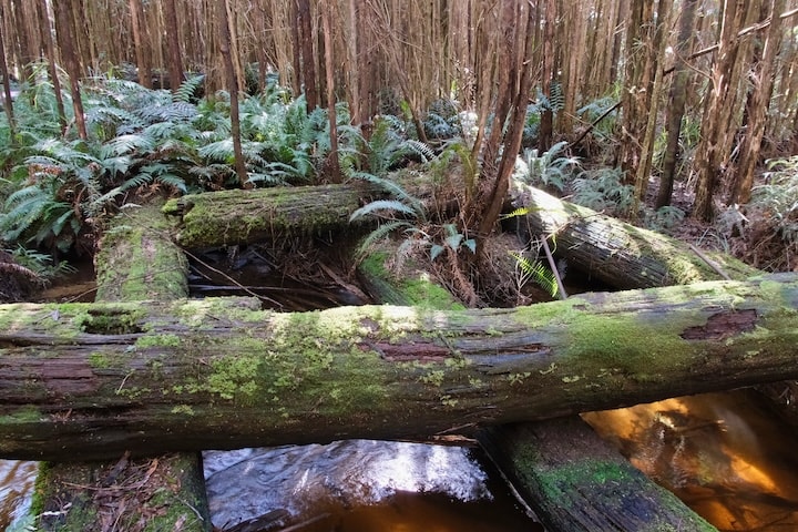 The remains of the tramway bridge over the Ada River. The bridge used to span the entire river valley, about a quarter of a mile9.
A gentle climb led us up towards the road. Clouds had begun blowing across the sky, and high above us the trees rustled in the breeze. Huge streamers of bark were strewn across the track, shed by the mountain ash.
After a short break at the road, we finished the last of the ascent back to the top of the High Lead incline. The descent began gently, but that didn’t last long and the track dropped savagely. Suitably warned by our recently slips, we were careful and managed to keep upright. Zigzagging along the path helped. Occasional flatter sections were a relief from the exertion of holding ourselves back.
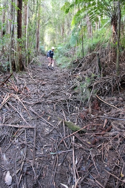 Descending the steepest part of the High Lead incline.
The last part before the next road was even steeper, and at times it was easier to step down sideways. Bare patches in the leaves showed where other walkers had slid, but our luck held and we avoided trouble. We took a break at the road, relieved that the trickiest part of the walk was over. The rest of the descent wasn’t hard, and when I again reached the gap cut through the mountain ash spanning the track, I knew we were down.
Back in the valley we crossed several side streams, their pure water washing the mud from our boots, and turning as cloudy as the Yarra. Along the causeway the tree trunks and stones were softly furred with moss. The sun was sinking towards the mountains behind us, and cast a golden light through the forest. In the shadows the foliage appeared all the more green in contrast.
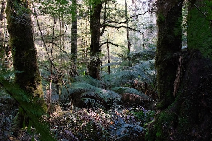 Back in the valley.
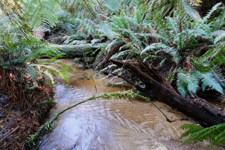 Big Creek.
A movement down near the creek drew my eye, and I glimpsed a lyrebird as it disappeared into the ferns with a cry of “whiss whiss whiss”. I was glad to finally see one of these shy birds after hearing them singing all day.
As we neared the end of the walk the low angle of the sunlight caught a dark branch lying near the track. When I got closer I realized it was an old rail, left behind after the tramway closed. I knelt down to look. Rust had eaten away at the metal, flaking off layer after layer to give it the appearance of bark. It broke apart easily at my touch, crumbling to the ground. In a few more decades the rail will be gone, but the forest will remain.
Annoyed chittering came from within the nearby undergrowth, reproaching me for my intrusion. I stood up and continued on, heading towards the road and the end of the walk.
Footnotes
- The Walk Into History runs from Big Pats Creek near Warburton to Powelltown (about 33 km) following old timber tramways. Some details are available on the Visit Yarra Valley website. The defunct Visit Warburton website used to have an excellent pamphlet describing the walk (archived copy). ↩︎
- The Light Railway Research Society of Australia have released a book describing the tramway which is available to download for free: Powelltown Tramway Centenary 1913-2013. This is well worth reading for the wealth of information it contains and the historical photographs. ↩︎
- A well-known point on the tramway to Powelltown was The Bump, where a tunnel 317 metres long (now closed) cut through the crest of the ridge. This also happens to be the watershed between the La Trobe and Little Yarra rivers: water on the east side eventually joins the Mitchell River in East Gippsland, while the west side flows into the Yarra River and on to Melbourne. ↩︎
- “High Lead” does not refer to the ridge itself, but rather to a method of logging where cables were suspended from trees to lift the logs being winched. See Stamford, Frank (1998). Arsenic and Molasses. Light Railway Research Society of Australia. p 64, 66. ISBN 0909340358. ↩︎
- The sign used to say: “Summit Winch Site / High Lead Inclines”. ↩︎
- Lyrebirds excel at mimicking sounds, particularly other birds, but can copy almost anything. ↩︎
- A saddle tank locomotive is one where the water tank sits on top of the boiler. For a photograph of “Squirt” refer to: Powelltown Tramway Centenary 1913-2013, p 4. Several more photographs can be found in: Stamford, Frank (1998). Arsenic and Molasses. Light Railway Research Society of Australia. ISBN 0909340358. ↩︎
- The sole purpose of the entire “Federal” operation — the logging, milling, and tramway — was to produce staves for barrels used to transport glucose. The barrels were burnt after a single use. See: McCarthy, Mike (2001). Mountains of Ash. Light Railway Research Society of Australia. p 261. ISBN 0909340412. ↩︎
- The 1939 fires burnt out the whole area, including the bridge. Afterwards it was reconstructed to help salvage the timber killed in the fire. For a photograph of the bridge see: Stamford, Frank (1998). Arsenic and Molasses. Light Railway Research Society of Australia. p 76. ISBN 0909340358. ↩︎
